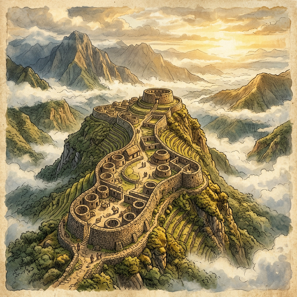
Archaeologists utilizing high-resolution LiDAR (Light Detection and Ranging) technology have uncovered a massive, previously unknown settlement of the Chachapoya culture in the dense cloud forests of the Huallaga Valley. The site, dubbed Kuntur-Wasi (Condor House), features a central stone fortress situated on a sharp ridge, surrounded by hundreds of circular dwellings and a sophisticated network of terraced orchards that span several kilometers across the mountain slopes.
The discovery is significant because it suggests the Chachapoya, or 'Cloud People', occupied a much larger territory and practiced more intensive agriculture than historical records indicated. Unlike the looted sites often found in the Andes, the remote nature of Kuntur-Wasi has kept its stone friezes and ceremonial platforms intact. Excavations are set to begin next month to investigate potential trade links between this mountain citadel and the low-lying Amazonian tribes.