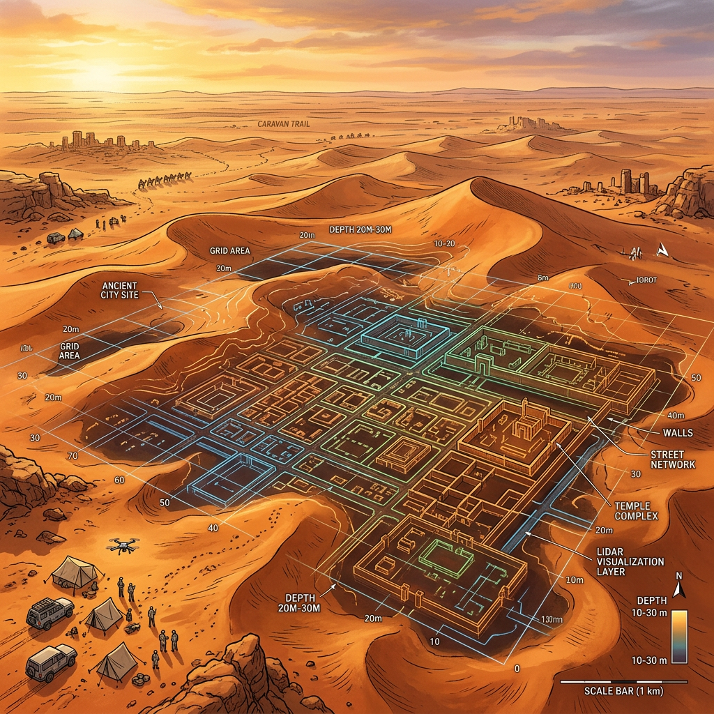
A breakthrough LiDAR survey over the Nafud Desert has identified the ruins of a massive, previously unknown Nabataean urban center. Dubbed 'Al-Ghamir' by researchers, the site covers over 150 hectares and features a grid-like street system, a central marketplace, and a sophisticated underground cistern network designed to capture rare flash-flood waters. This discovery suggests that the Nabataean Kingdom’s trade influence extended much deeper into the hyper-arid interior than previously theorized.
Unlike the rocky architecture of Petra or AlUla, Al-Ghamir appears to have been constructed primarily from sun-dried brick and local limestone, which helped it remain hidden beneath shifting dunes for nearly two millennia. The discovery of high-quality Roman ceramics and Indian peppercorn traces at the site confirms its role as a vital pit-stop on the Trans-Arabian incense route during the 1st century CE.