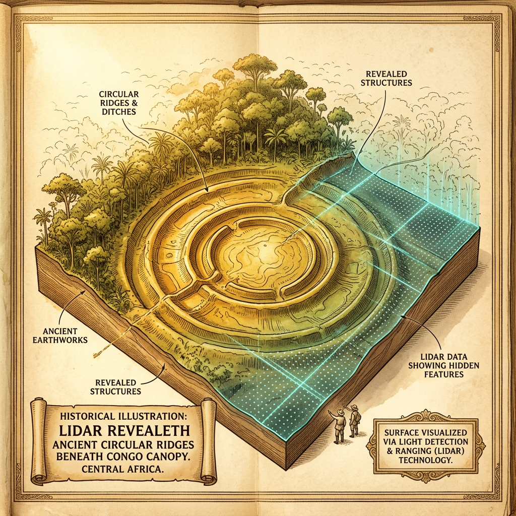
In a revolutionary survey of the dense rainforests in the Congo Basin, LIDAR (Light Detection and Ranging) technology has pierced through the thick canopy to reveal a massive network of concentric earthen enclosures. These structures, some spanning over 400 meters in diameter, are part of a previously unknown urban tradition that flourished between 400 and 600 CE. The discovery points to a highly organized society capable of managing large-scale earthworks within a tropical environment.
Initial ground-truthing of the site has uncovered vast 'black soil' patches, or Terra Preta, which are highly enriched with charcoal and nutrients. Scientists believe these areas were used for the intensive cultivation of yams and oil palms, supporting a population density far greater than previously estimated for pre-modern Central Africa. This find fundamentally shifts the understanding of early African urbanism and its relationship with the rainforest ecosystem.