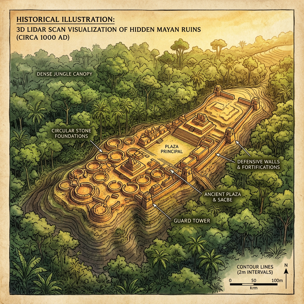
A new LiDAR mapping project in the Cuchumatanes Mountains of Guatemala has identified a previously unknown Maya complex designed specifically for long-term food security. The site features several dozen circular stone silos built into the mountain slopes, protected by a series of defensive walls and watchtowers. This "Seed-Bank" likely served as a regional reserve during the prolonged droughts that characterized the Terminal Classic period.
The strategic location of the granaries at high altitudes provided a natural cooling effect, essential for preserving maize and bean seeds over multiple seasons. The discovery highlights the advanced logistical planning and collective effort the Maya employed to mitigate the effects of environmental instability and warfare during the 9th and 10th centuries.