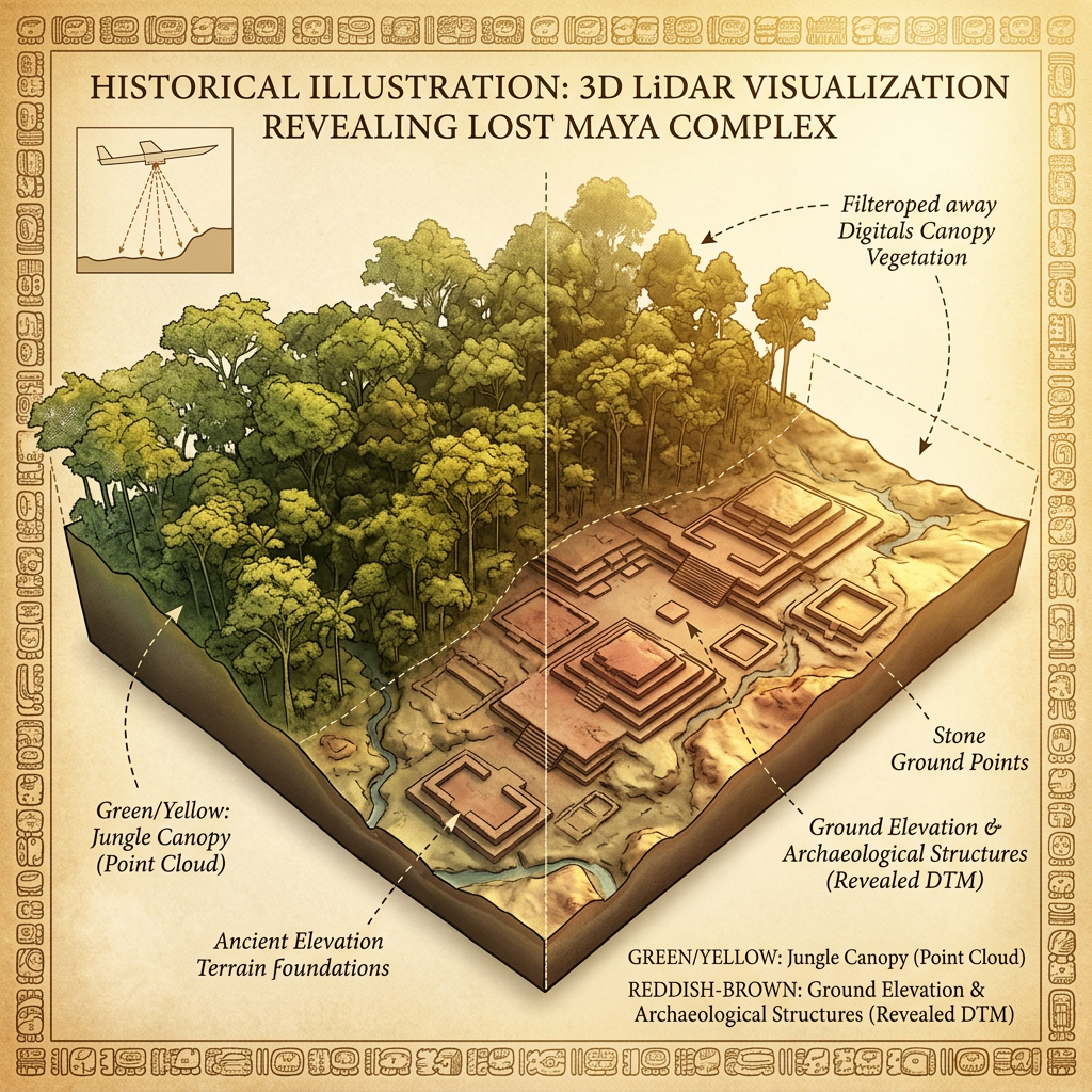
Recent high-resolution LiDAR surveys over the northern Petén region of Guatemala have revealed a sprawling Maya agricultural center that challenges previous models of jungle farming. The laser mapping shows over 5,000 individual terraces arranged in a massive concentric pattern around a central ceremonial plaza, capable of supporting a city population far larger than previously estimated.
The LiDAR Maya discovery also identified a complex gravity-fed irrigation system that diverted seasonal rainwater through stone-lined channels into subterranean cisterns. This infrastructure suggests that the Maya achieved a level of agricultural intensification and hydrological engineering that allowed them to survive prolonged droughts during the Late Classic period. Researchers believe this site served as a regional breadbasket for the nearby city of Tikal.