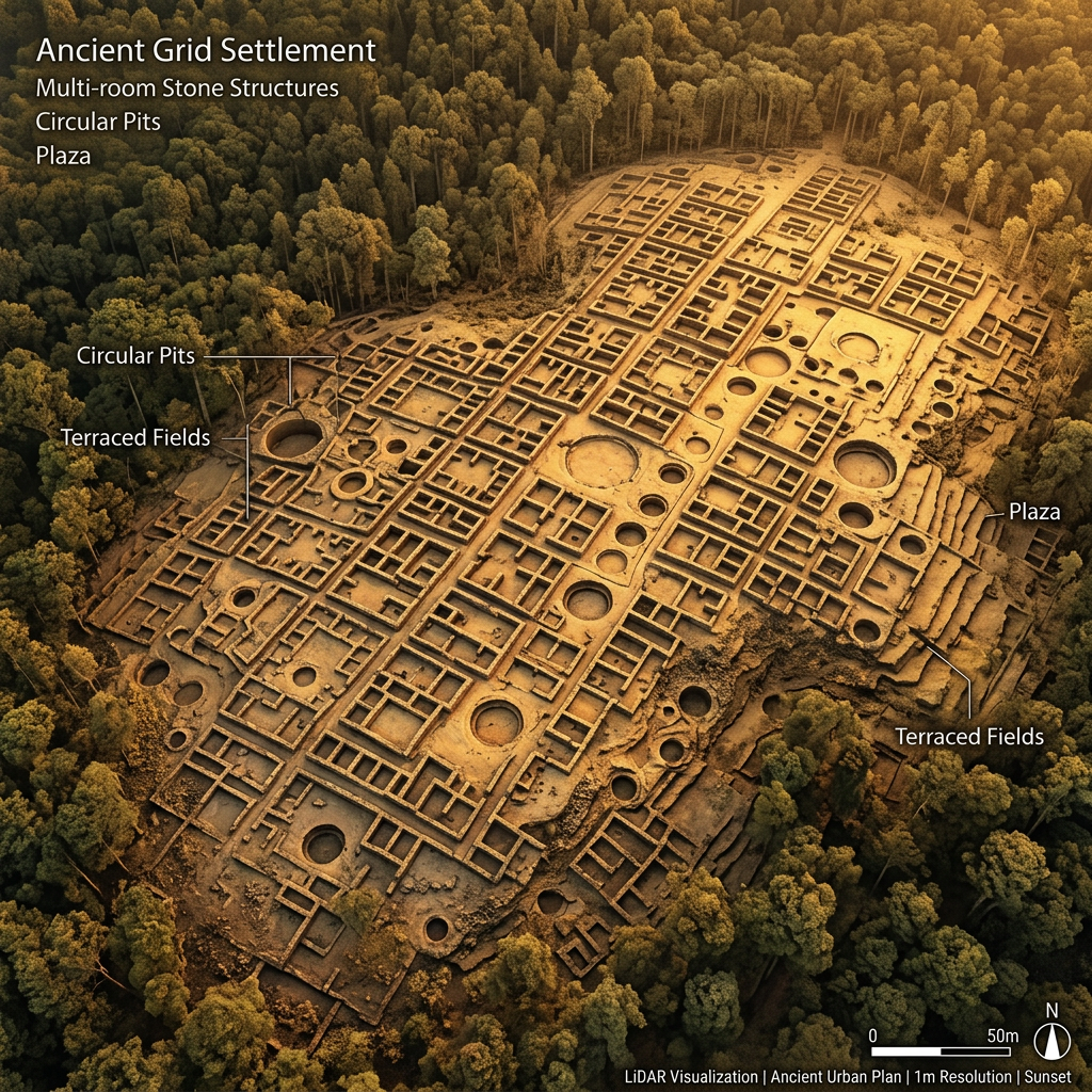
Researchers using high-resolution LiDAR have mapped a previously unknown Ancestral Puebloan urban center hidden beneath dense forest canopy in the Jemez Mountains. The site, dubbed the Valles Citadel, includes over 200 interconnected rooms, several large ceremonial kivas, and a sophisticated system of stone-walled terraces designed for high-altitude maize cultivation.
The discovery suggests that the Ancestral Puebloan population was much more widely distributed across the northern high plateaus than historical records indicate. The mapping revealed a massive defensive perimeter wall surrounding the central plaza, indicating that regional conflicts or a need for resource security prompted the construction of fortified highlands during the late 8th century.