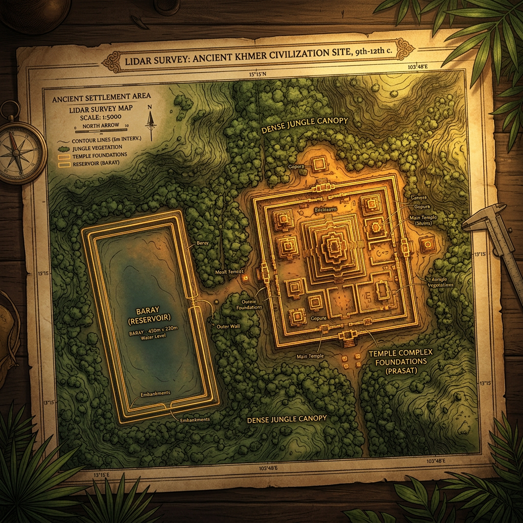
A high-resolution LIDAR (Light Detection and Ranging) survey conducted over the northern Cambodian forest has successfully mapped a previously unrecorded Khmer Empire temple complex. Preliminary dating suggests the site was constructed during the reign of Jayavarman IV (10th century CE) as a satellite sanctuary for the imperial capital at Koh Ker.
The survey reveals a large baray (reservoir) and several brick towers that have been completely overtaken by forest canopy. Ground verification teams recently reached the site, finding Sanskrit inscriptions on door lintels that celebrate the inauguration of a local agricultural cult dedicated to the wind god.