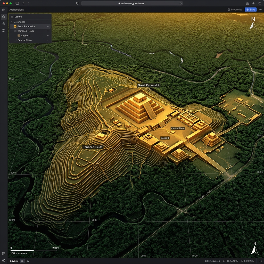
Using advanced LiDAR technology, researchers have mapped a previously unknown Huastec urban center hidden beneath the dense jungle canopy in San Luis Potosí, Mexico. The site features an extensive network of terraced agricultural fields and a fortified central plaza containing several stone pyramids.
The discovery suggests the Huastec civilization possessed a much more complex social structure than previously recorded. The urban grid indicates a high level of centralized planning focused on large-scale food production and defensive positioning against neighboring highland groups.