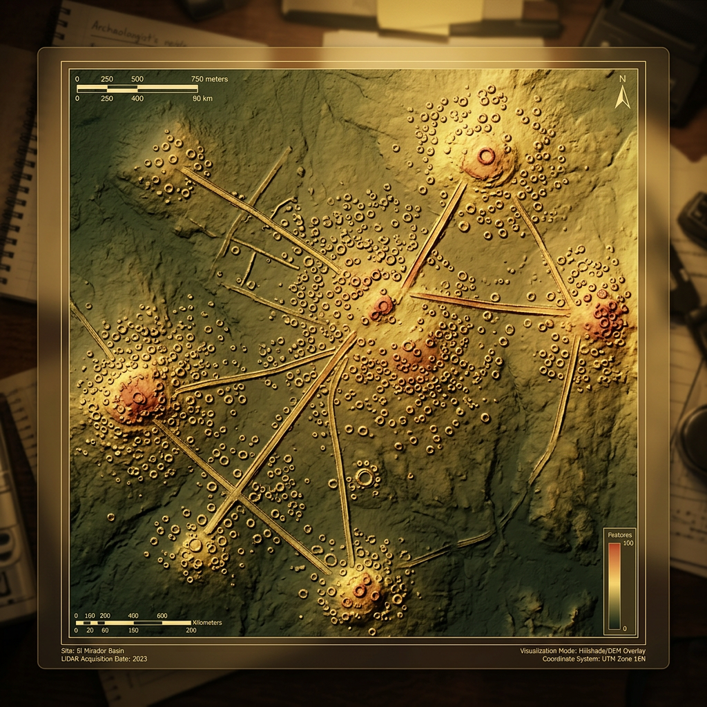
A breakthrough LiDAR survey in the dense jungles of the Darién Gap has identified a massive pre-Columbian urban center characterized by a unique industrial focus. Spanning over 15 square miles, the settlement features a central ceremonial plaza surrounded by thousands of circular stone foundations used for processing Theobroma cacao. This suggests the region was a primary production hub for trade-grade chocolate long before European contact.
Researchers identified sophisticated terraced slope management and gravity-fed irrigation channels that sustained large-scale orchards. The mapping reveals a highly organized grid system with elevated residential sectors connected to the industrial plazas by paved causeways. This finding provides the first evidence of a large-scale, specialized economy in this remote borderland between Central and South America.