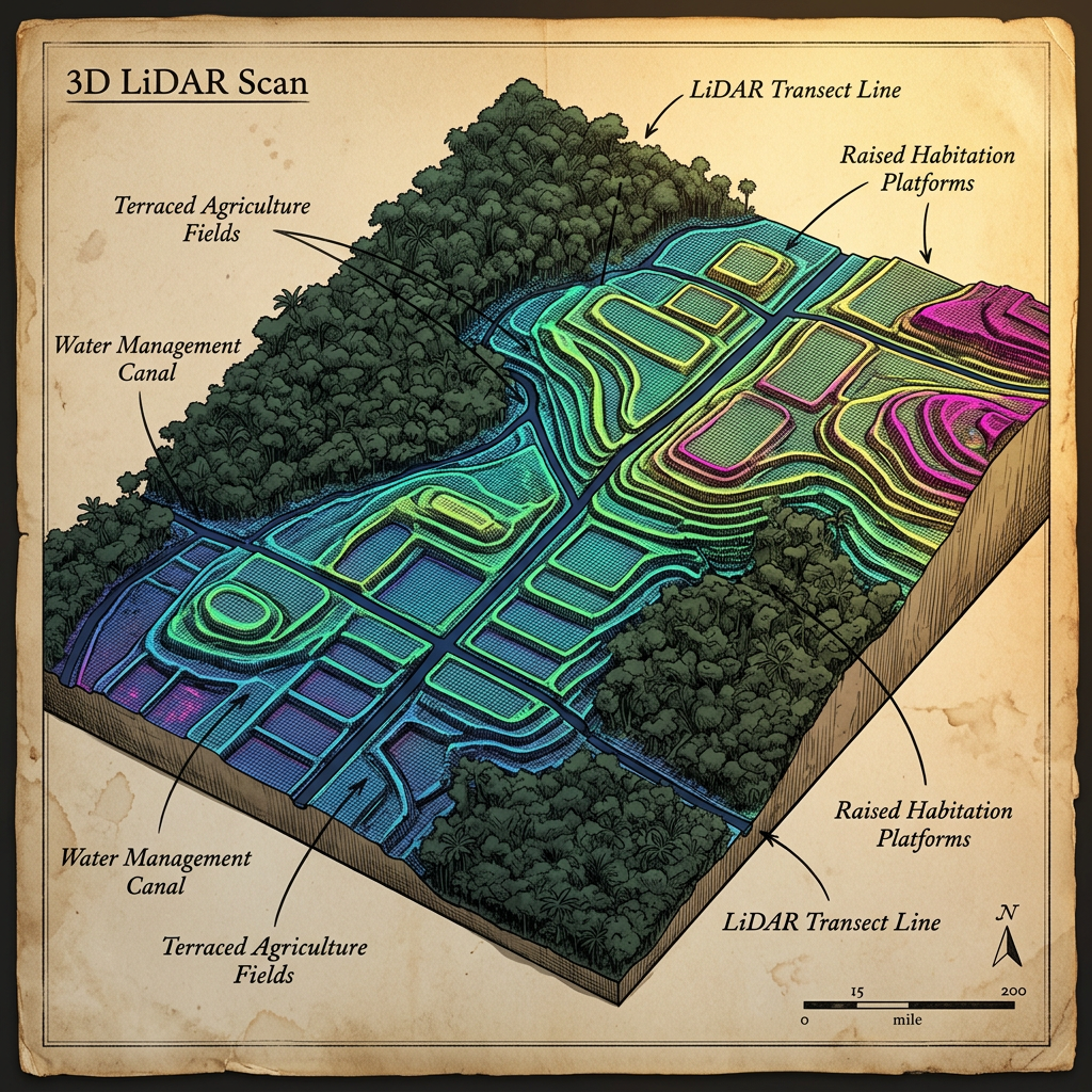
Advanced LiDAR mapping conducted over the remote Campeche jungle has unveiled a massive 1,200-year-old Maya agricultural complex consisting of 'marsh-rice hydraulic terraces.' This discovery challenges the long-held belief that the Maya relied almost exclusively on maize and root crops. The mapping reveals a sophisticated grid of sluice-gated paddies and specialized water-retention basins designed to cultivate semi-aquatic grains in the seasonal wetlands of the Yucatan Peninsula.
The National Institute of Anthropology and History (INAH) reports that the complex spans over 15 square kilometers and includes elevated walkways for farmers to manage water levels during the tropical rainy season. The precision of the terraced engineering suggests the Maya had developed a highly localized form of wetland cereal cultivation that allowed for multiple harvests per year, supporting the high population densities of the Late Classic period.