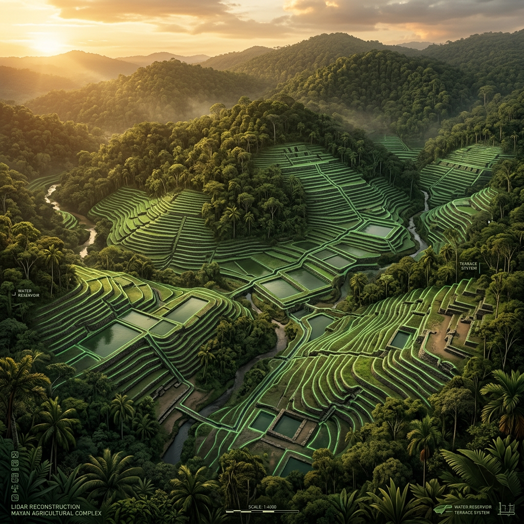
A high-resolution LiDAR survey conducted over the remote Lacandon Jungle in Chiapas has identified a sprawling Maya Terrace-Farming Mega-Hub spanning over 50 square kilometers. The data reveals an incredibly dense network of thousands of individual agricultural terraces, interconnected by a series of sophisticated sluice-gate reservoirs. This system allowed for the precise management of rainwater during the erratic seasons of the Terminal Classic period, supporting an estimated population three times larger than previously believed for this region.
The mapping also detected a central administrative plaza featuring several E-Group astronomical complexes, which likely functioned as ritual calendars to time the planting and harvesting cycles. Unlike the previously known 'hanging gardens' of the Andes, these Maya structures show a unique vertical hydroponic integration where nutrient-rich silt was recycled from lower canals back to the upper terrace levels. This discovery challenges existing models of Maya agricultural collapse and highlights their resilience through advanced geo-engineering.