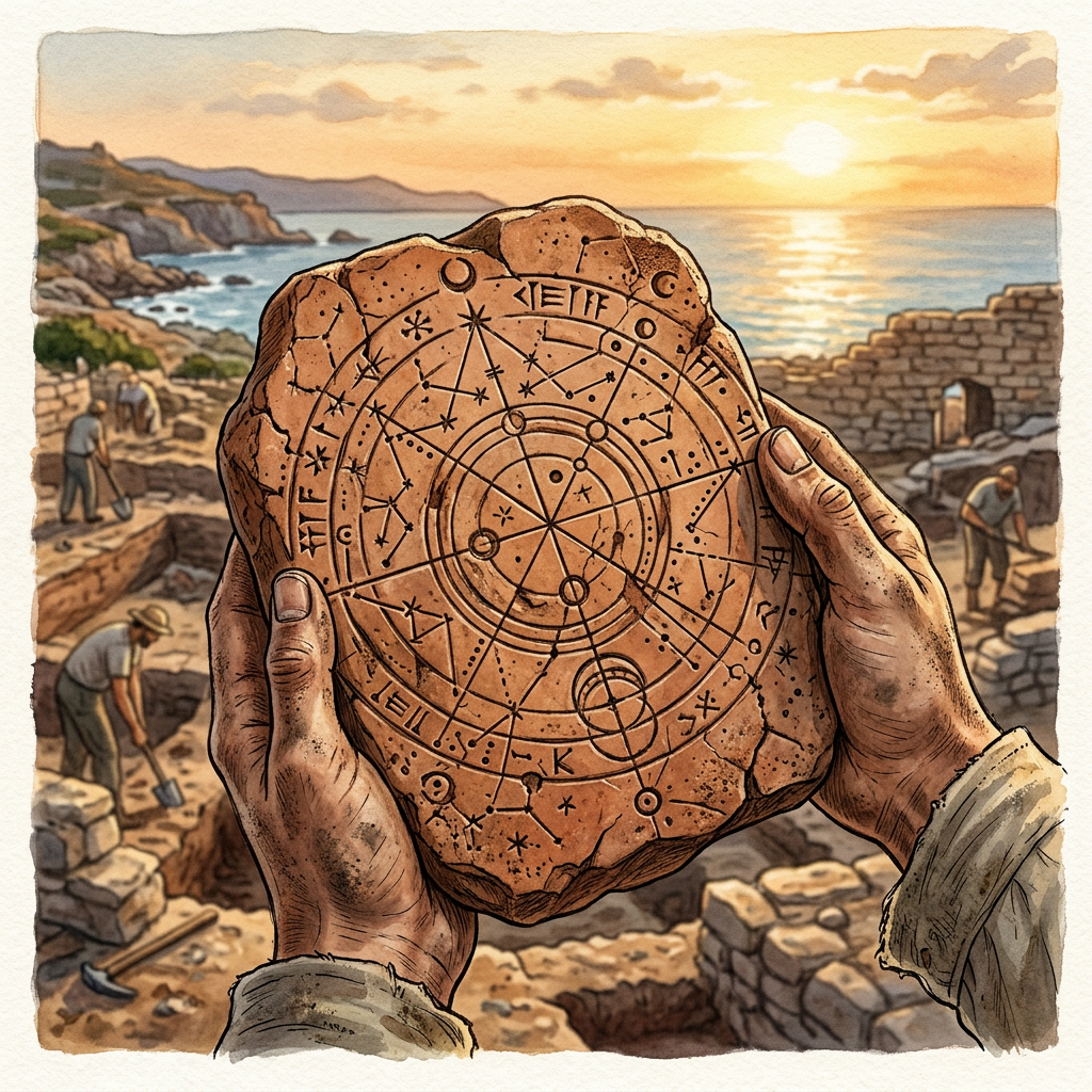
Archaeologists excavating a previously undocumented Harappan outpost in coastal Gujarat have uncovered the private archive of a high-ranking official titled the 'Master of the Royal Seafarers.' The find includes a cache of over fifty terracotta navigational charts that utilize a series of geometric incisions to represent celestial alignments and coastal landmarks. This is the first direct evidence of sophisticated maritime cartography within the Indus Valley Civilization, providing a glimpse into the advanced nautical knowledge used to navigate the Arabian Sea.
The excavation also yielded several steatite seals depicting multi-oared vessels and stone anchors, alongside a series of clay ledgers recording the arrival of trade missions from the Persian Gulf. Scholars suggest that the facility functioned as a maritime training academy and bureaucratic center, where pilots were instructed on the seasonal monsoon winds and property deeds for seagoing vessels were registered. The site’s location on a protected estuary indicates it served as a vital staging point for Harappan exports to Mesopotamia and beyond.