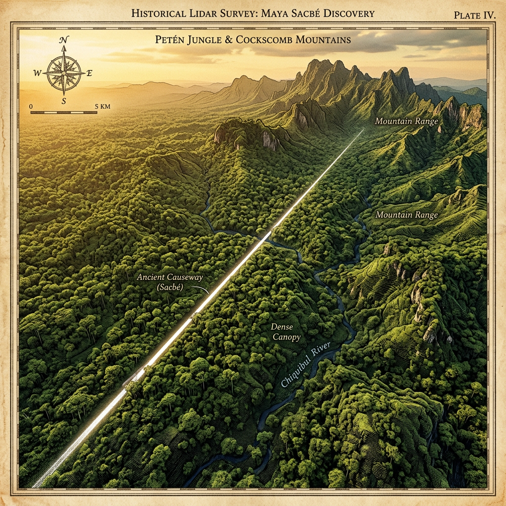
A high-resolution LiDAR survey in the dense jungles of the South-Western Petén has identified a previously unknown 15-mile sacbeh (paved road) that leads directly to a cluster of karst mountains. Unlike typical trade roads, this path is lined with small, tiered platforms and leads to the entrances of several modified caves containing Maya ritual offerings.
The mapping reveals that the Maya constructed artificial embankments to guide pilgrims through the difficult swampy terrain toward these sacred cave-shrines. Preliminary ground surveys have already located intact polychrome vessels and carved jade ornaments, suggesting the route was used by elites for seasonal petitions to rain deities during the Late Classic period.