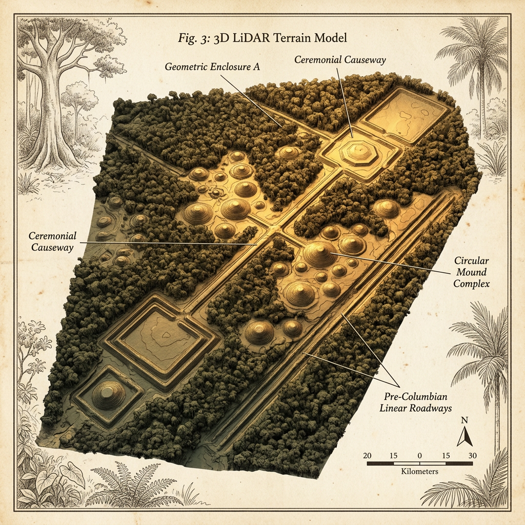
An international team using high-resolution LiDAR technology has mapped an expansive and previously unknown network of earthworks hidden beneath the dense canopy of the Araucaria forests in southern Brazil. The survey revealed over 400 concentric ritual mounds connected by a geometric system of causeways that appear to be aligned with the winter solstice. This discovery suggests that the pre-Columbian cultures of the Brazilian highlands were far more numerous and socially complex than previously estimated.
The LiDAR data indicates that the site functioned as a massive regional pilgrimage center, with the causeways extending for miles to connect disparate hilltop settlements to the central ritual plazas. Initial ground surveys have identified stone-lined fire pits atop the larger mounds, containing charred remnants of local pine nuts used in communal feasts. This network represents one of the largest pre-Columbian architectural complexes ever identified in South America's southern interior.