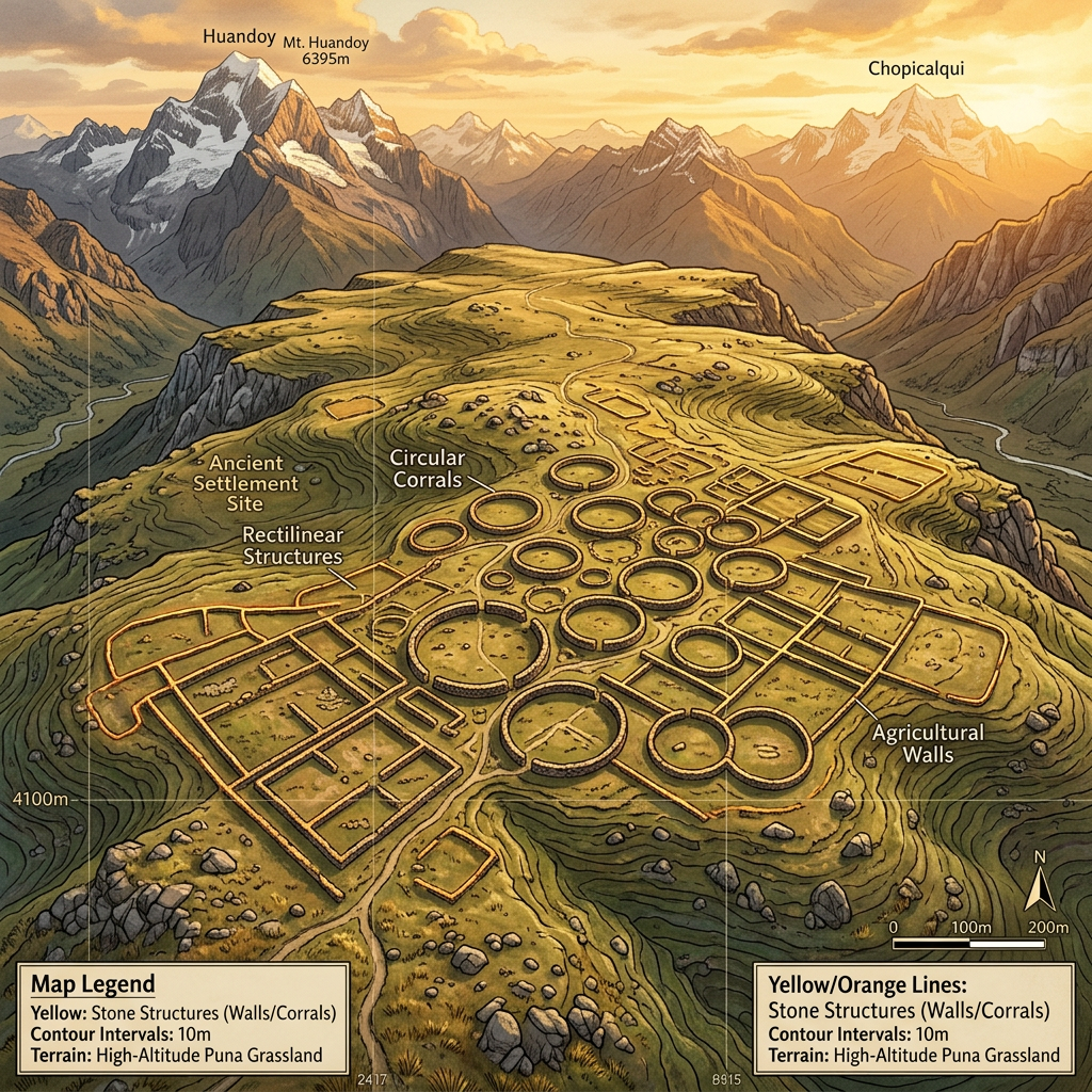
A high-resolution LiDAR survey conducted in the high-altitude regions of the Southern Andes has identified a sprawling, previously unknown Tiwanaku logistics hub. The site, situated at an elevation of 4,200 meters, features a massive central plaza surrounded by over 200 stone-lined corals and subterranean storage vaults, indicating its primary function as a major node in the trans-Andean llama caravan trade.
Mapping data reveals a network of paved roads radiating from the hub, connecting remote agricultural valleys to the Tiwanaku heartland. The discovery suggests that the Tiwanaku state maintained a much more sophisticated and centralized control over high-altitude resource distribution than previously understood, utilizing these 'mountain ports' to manage the flow of salt, dried meat, and obsidian across the empire.