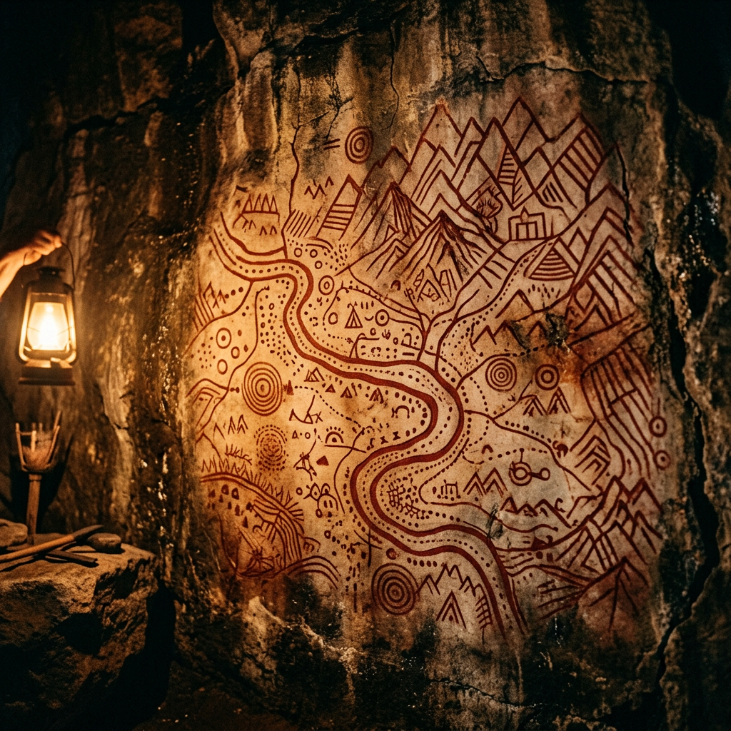
In a remote section of the Great Dividing Range, researchers have documented a unique cave painting that appears to be a topographical map of a 500-kilometer territory. Painted in deep red ochre and charcoal, the mural depicts rivers, mountain ridges, and specific cave systems that match the local geography with surprising accuracy. Symbolic markers indicate permanent water sources and what are believed to be sacred seasonal meeting grounds.
This "navigation map" predates any other known cartographic artifact by nearly 10,000 years. Analysis of the pigments suggests the map was maintained and updated over several generations, serving as a vital knowledge repository for nomadic groups navigating the challenging terrain of the late Pleistocene. This discovery reshapes our understanding of early human spatial cognition and territorial organization.