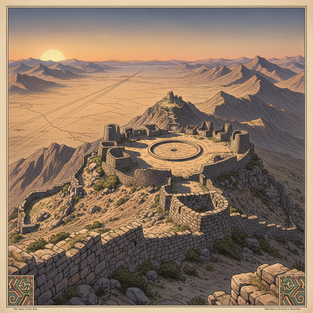
Using high-resolution LiDAR technology, researchers in Peru have identified an extensive Wari Empire logistics hub situated on a 4,000-meter-high plateau. This site appears to have been the primary administrative center for the creation and maintenance of high-altitude geoglyphs that served as territorial markers and astronomical guides. The mapping reveals a series of residential quarters, stone tool depots, and ritual platforms overlooking a vast network of geometric lines carved into the mountain soil.
Field inspections at the site uncovered specialized obsidian leveling tools and ceramic vessels used to transport pigments from the lowlands. The complex suggests that the Wari engaged in state-sponsored landscape engineering on a scale previously unrecognized. The discovery reshapes our understanding of how pre-Incan empires managed vast, rugged territories through symbolic and physical infrastructure.