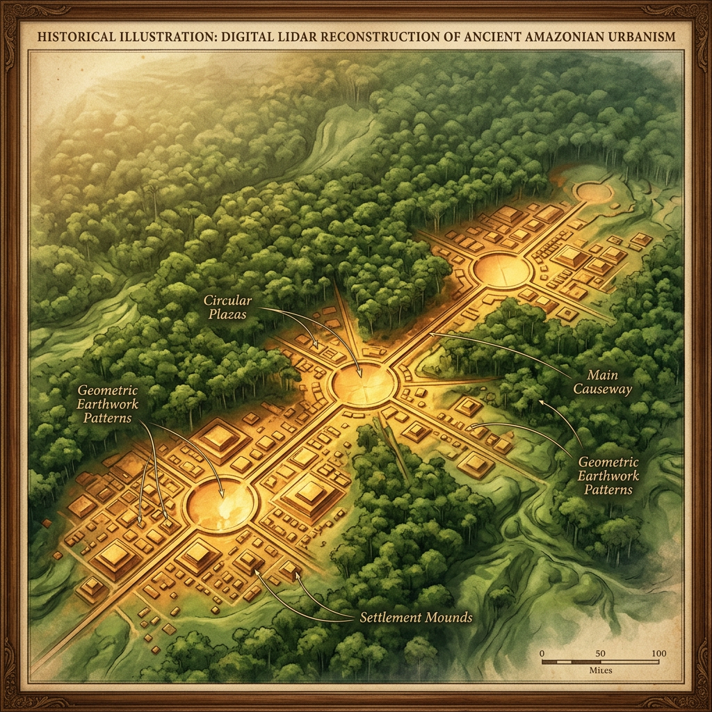
Groundbreaking LiDAR (Light Detection and Ranging) technology has pierced the dense rainforest canopy of Brazil’s Mato Grosso region to reveal a sprawling urban network. The data shows over 20 interconnected settlements characterized by massive circular plazas and raised causeways. Strikingly, the entire urban layout appears to be astronomically aligned, mirroring the position of the Orion constellation during the winter solstice.
The scale of the infrastructure suggests a highly centralized political entity that flourished between 800 and 1200 CE. These "Star Cities" were supported by an extensive system of engineered fish weirs and fruit orchards, proving that the Amazonian interior supported far larger and more complex societies than previously hypothesized by historians.